The paradox of international cooperation
Billions invested, yet decisions based on obsolete data
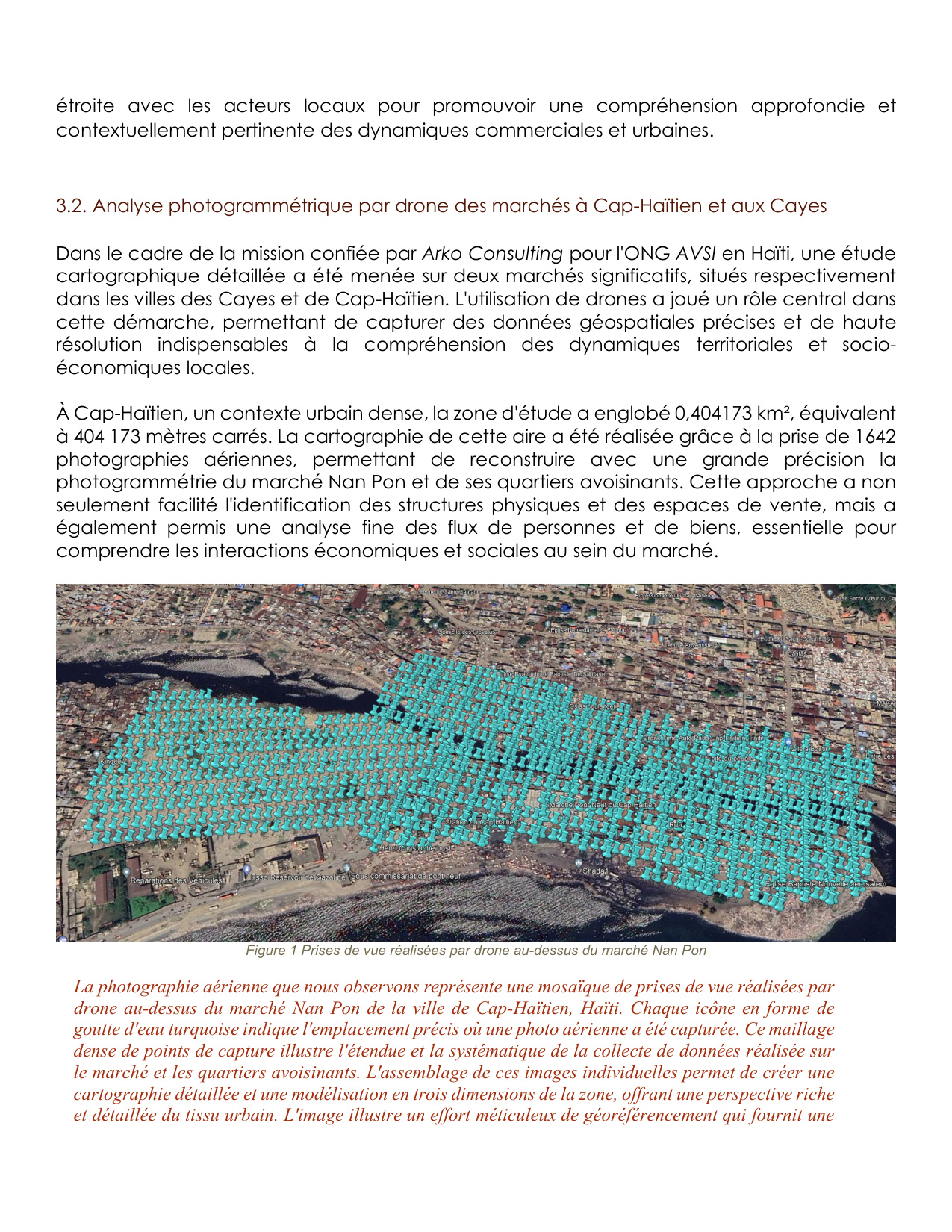
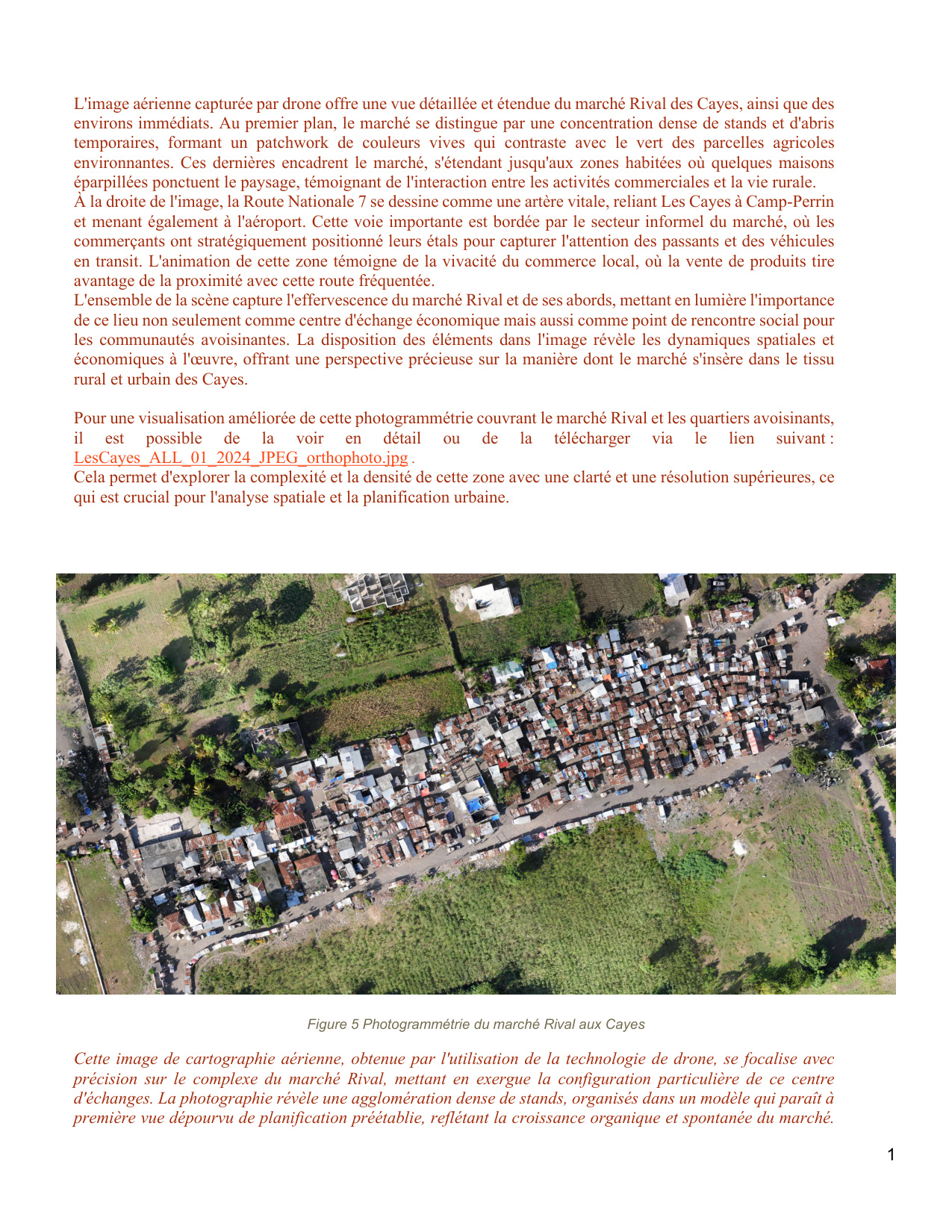
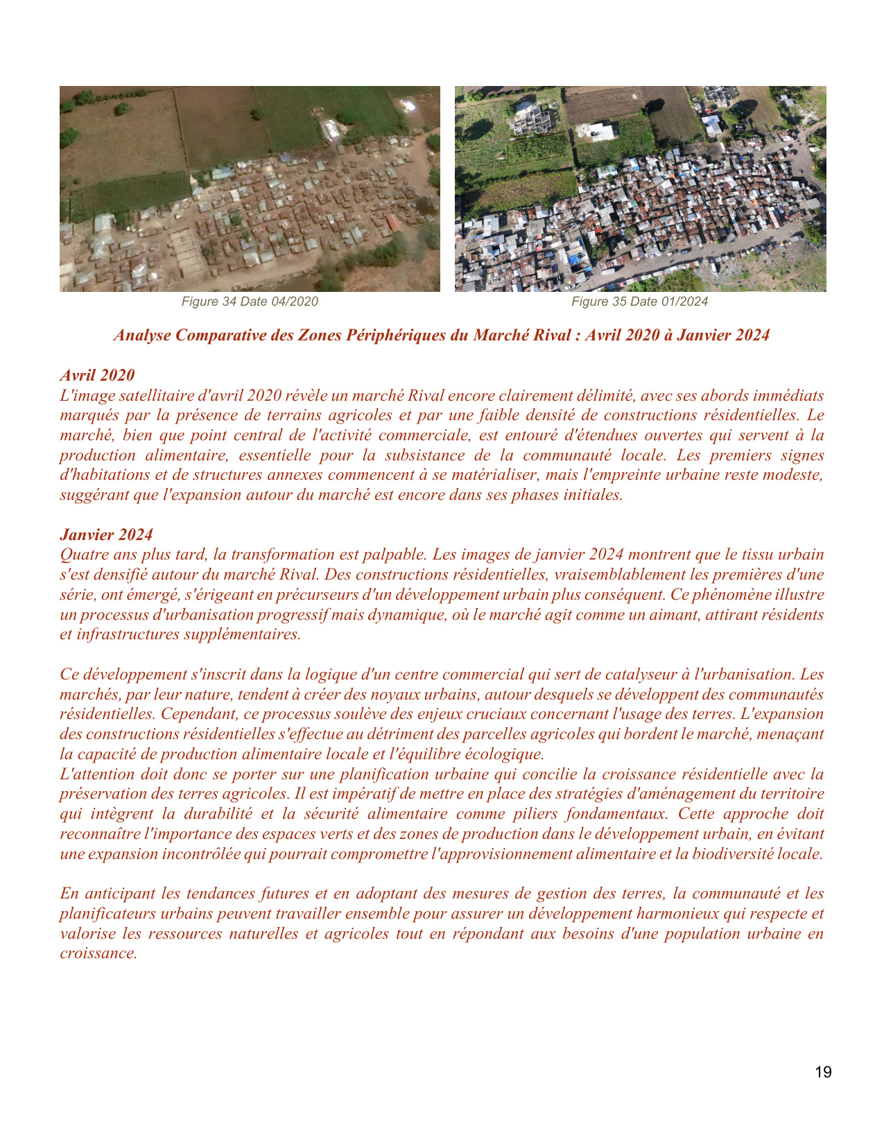
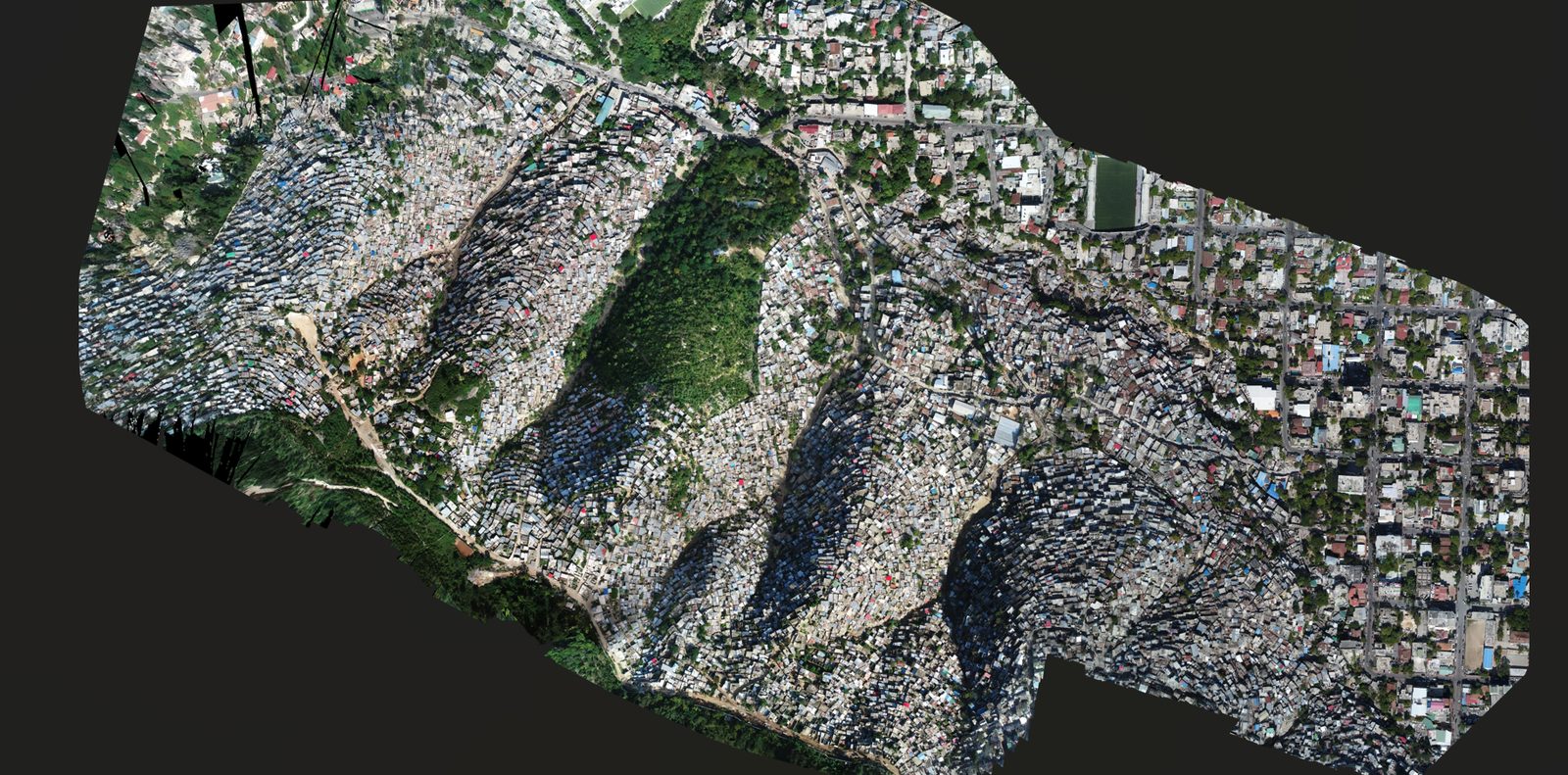
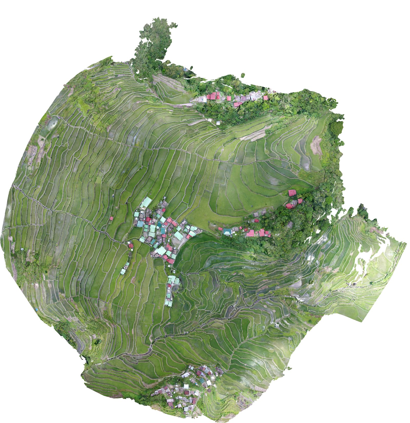
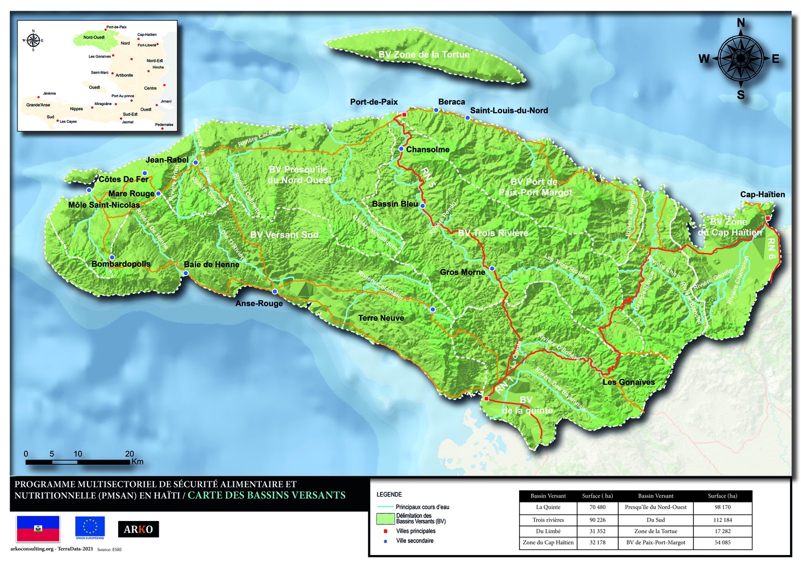
TerraData in the field — Haiti
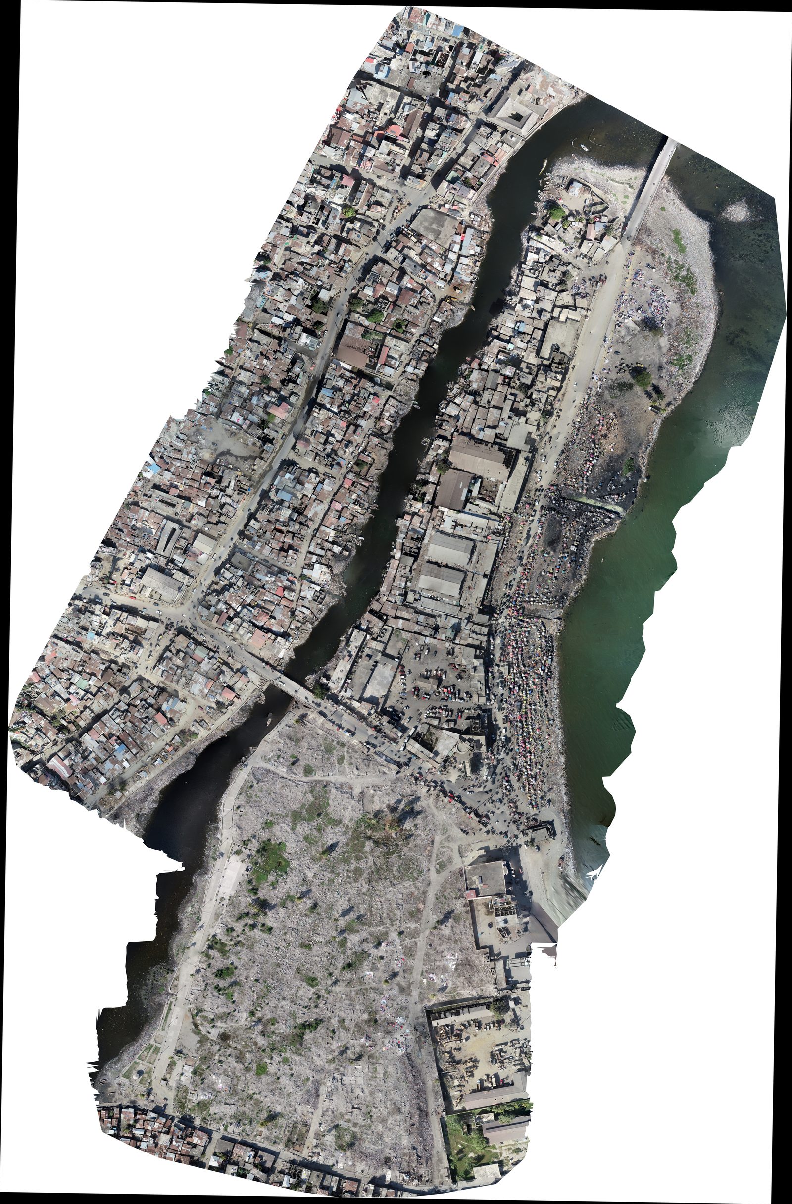
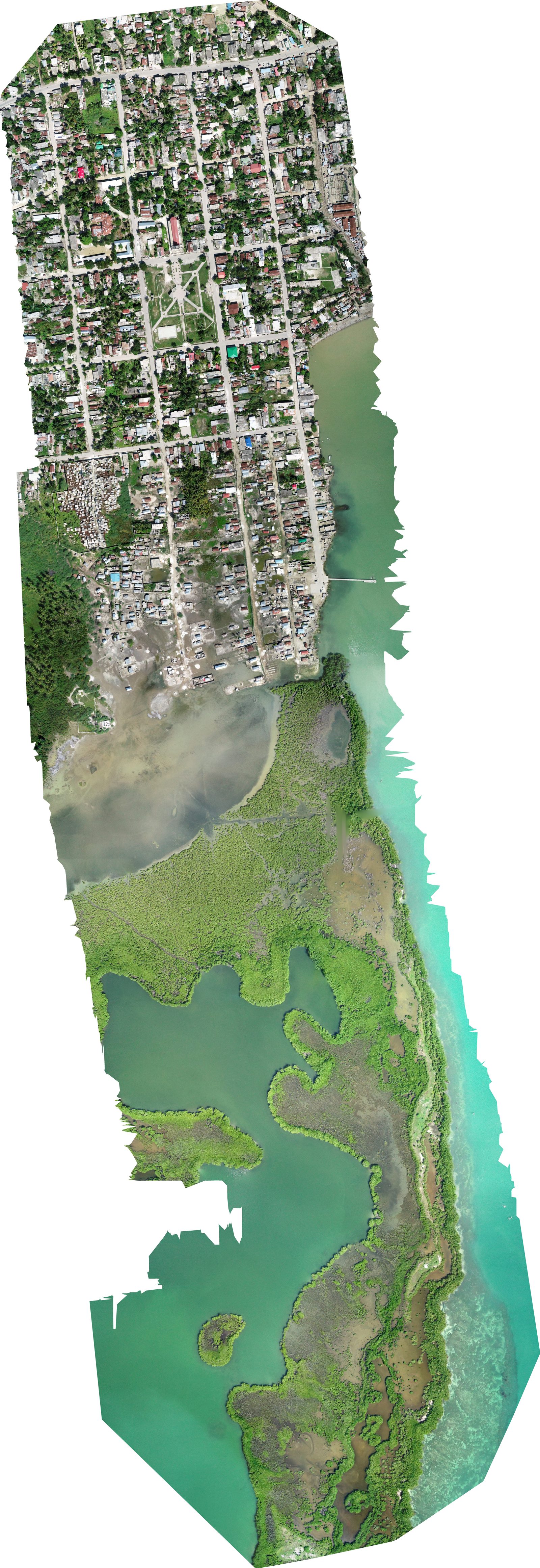
In Haiti, TerraData documented by drone coastal areas inaccessible by road — including Caye Sable, a 0.16-hectare island where 150 to 250 people live without any basic services, absent from all official maps. This type of aerial documentation directly feeds climate vulnerability assessments and donor intervention strategies.
Field missions on video
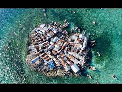
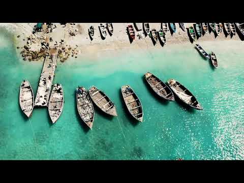
Neverland — Caye Sable, Haiti
4K aerial documentation · 63K views

UNDP/CATIE — EbA Project Haiti
Massif de la Selle · Short version
UNDP/CATIE — EbA Project Haiti
Full documentary · 18 min
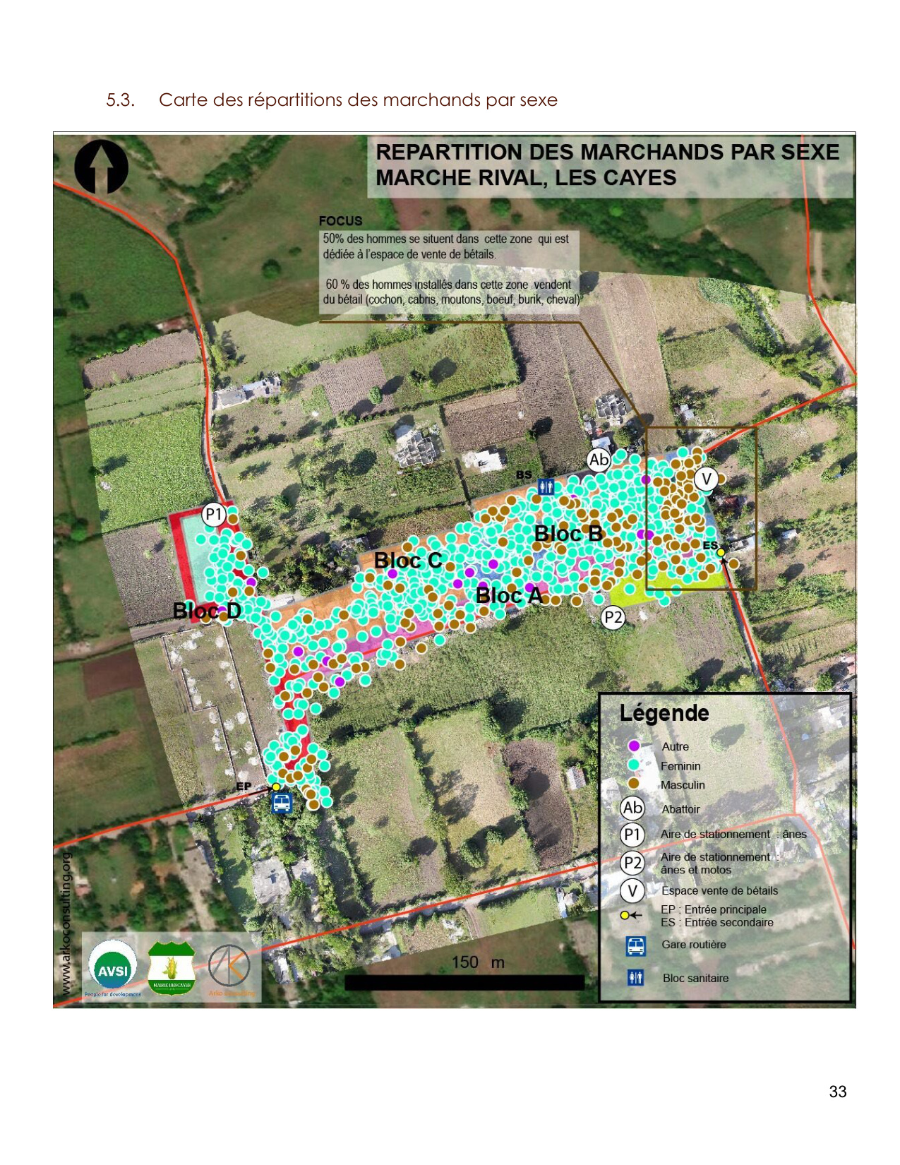
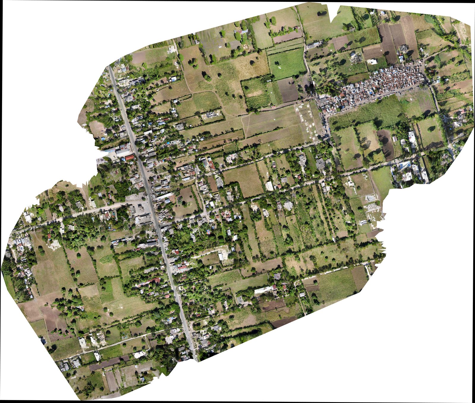
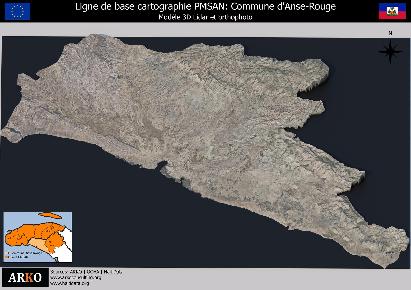
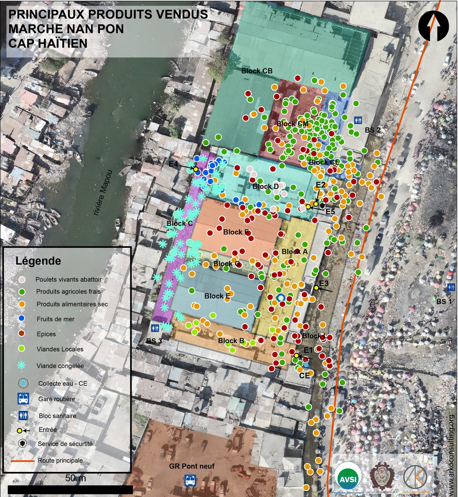
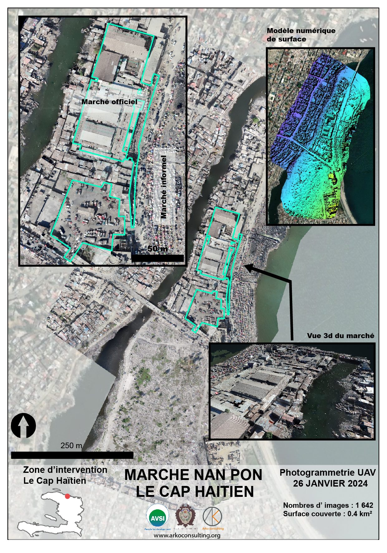
Field portfolio — Drone & GIS products
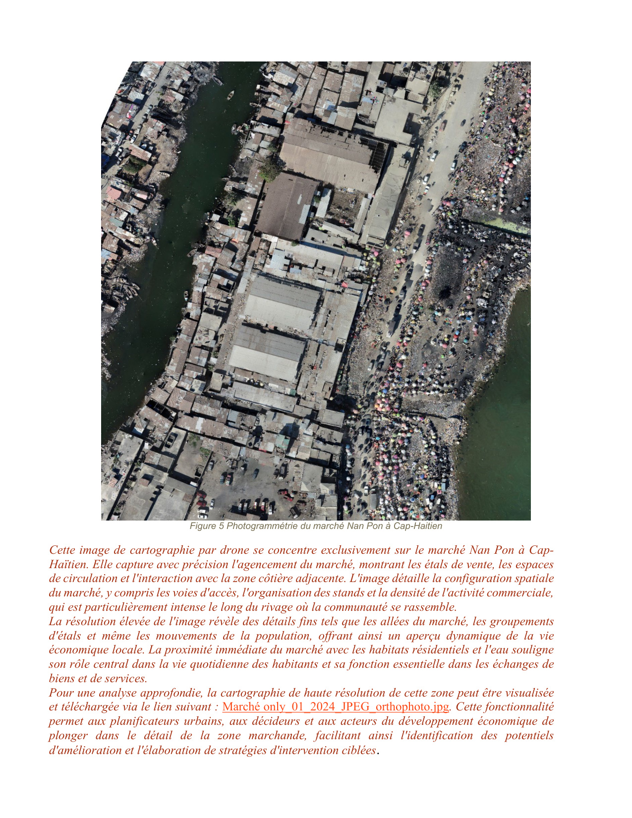
Orthophotos, 3D models, thematic mapping, and GIS analyses produced by TerraData in Haiti and the Caribbean.
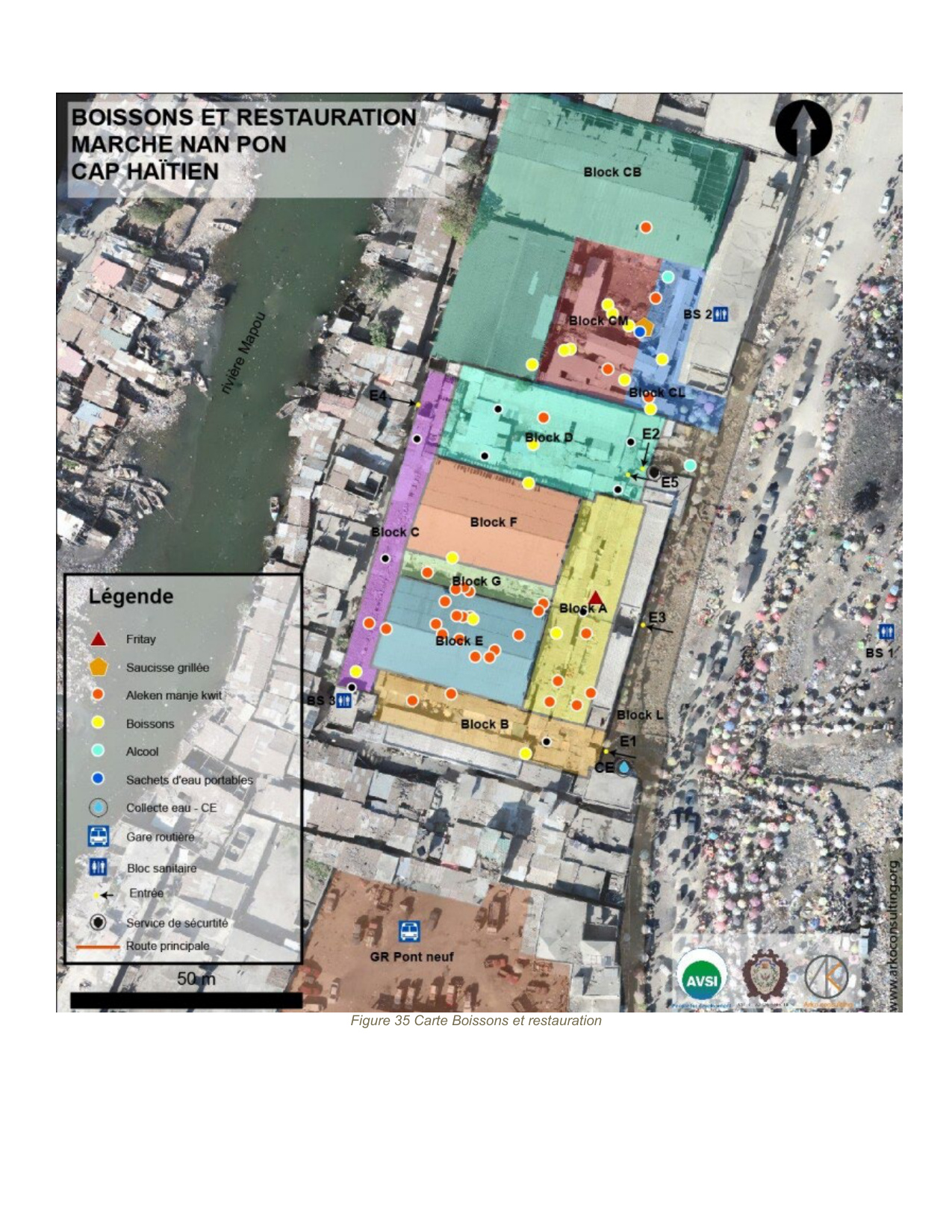
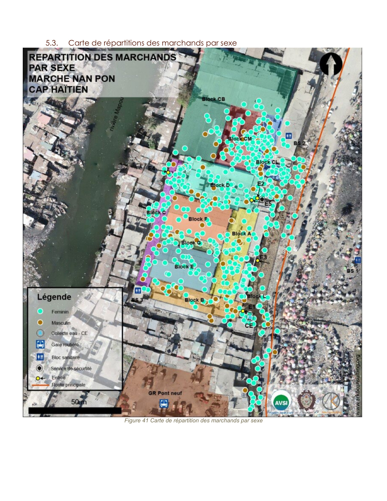
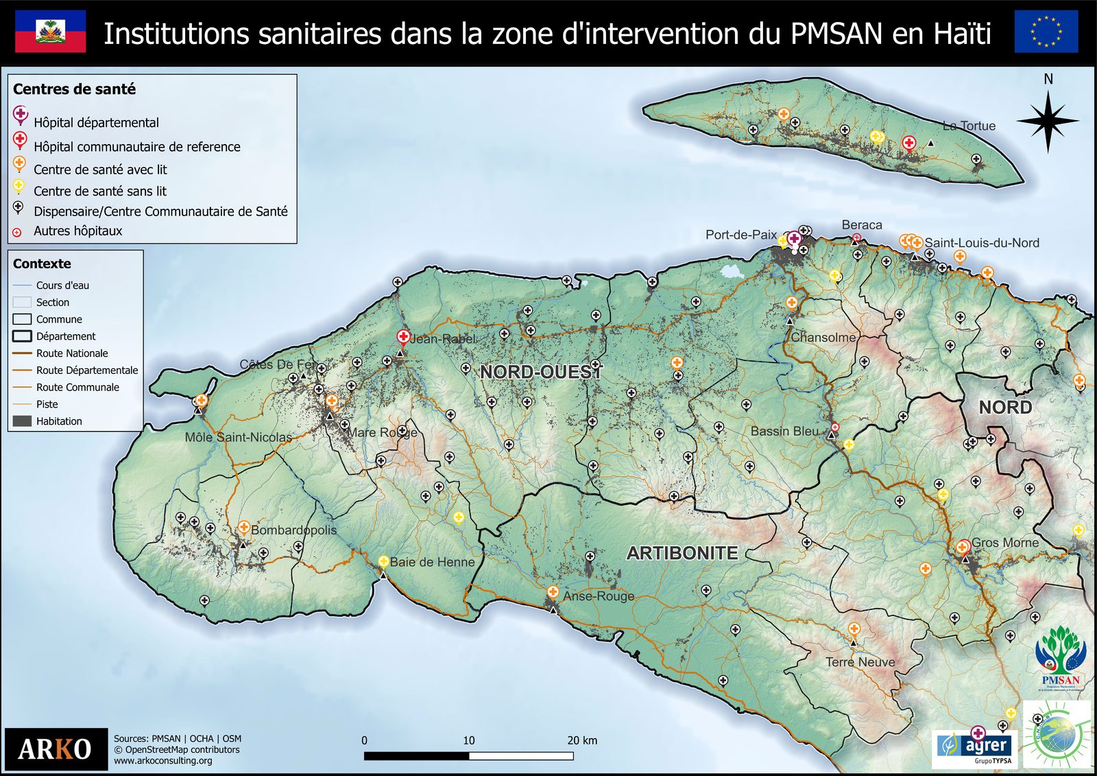
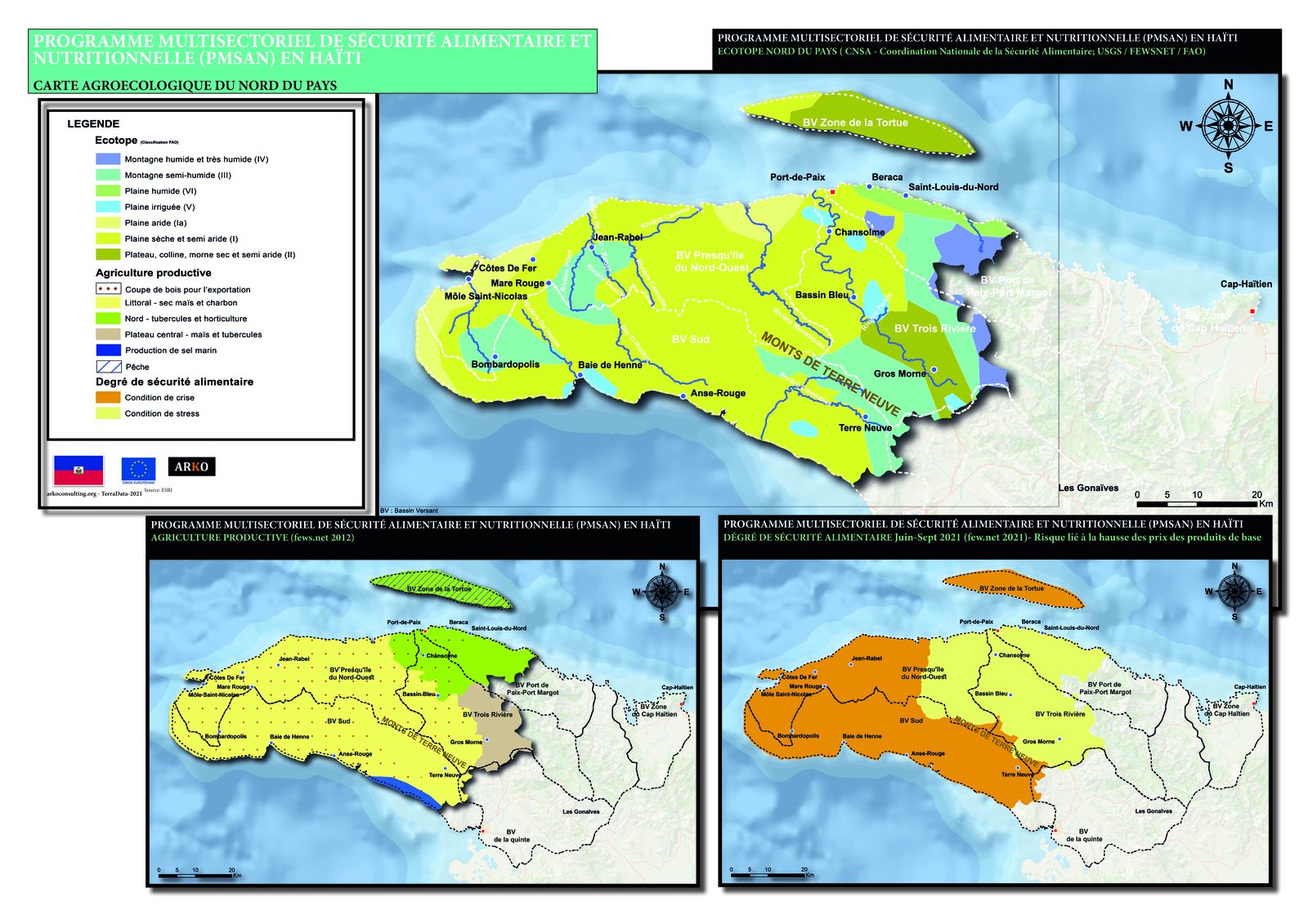
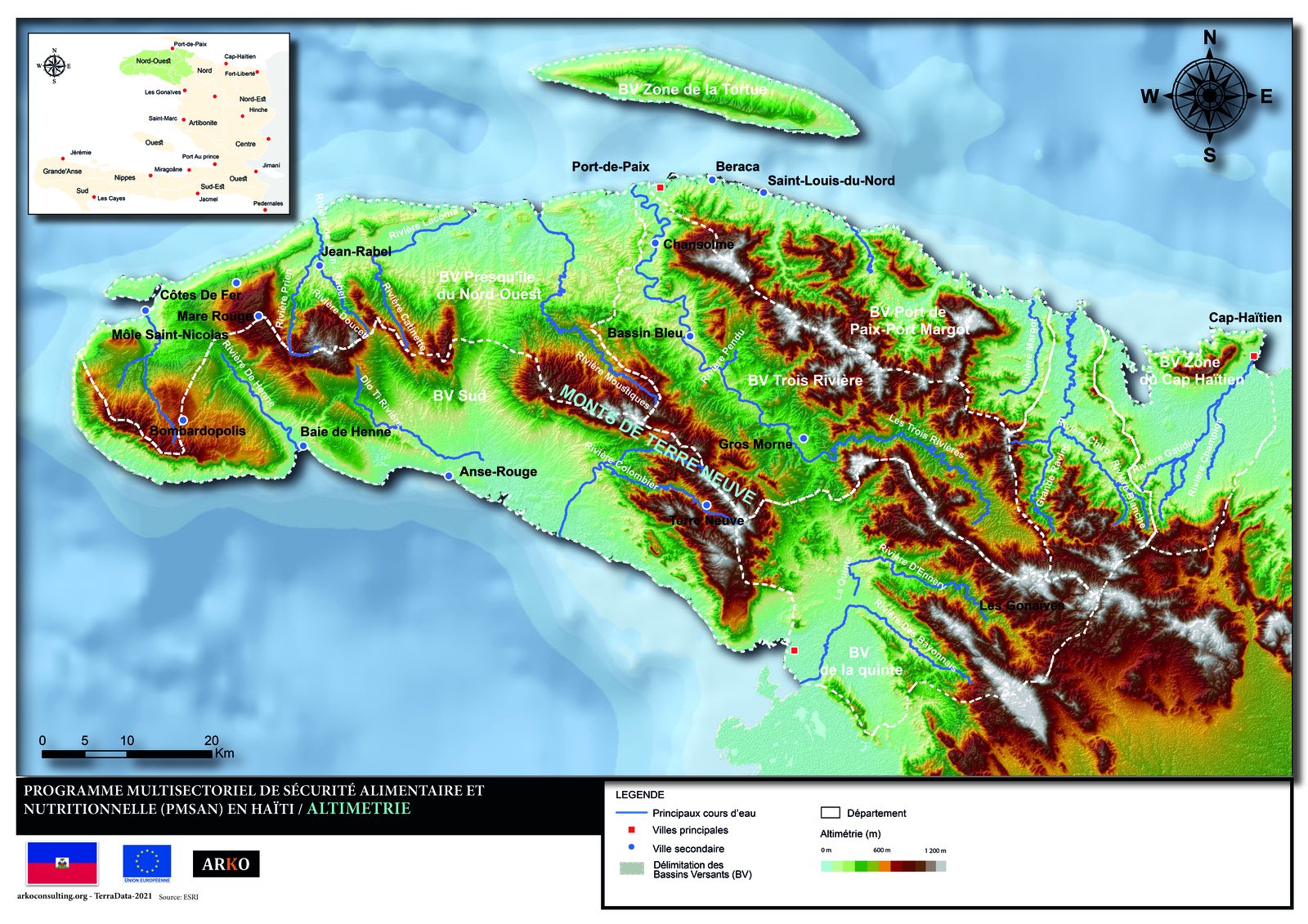
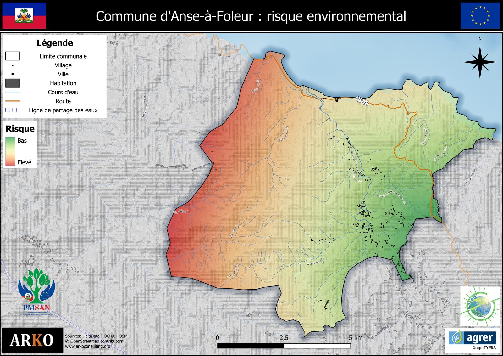
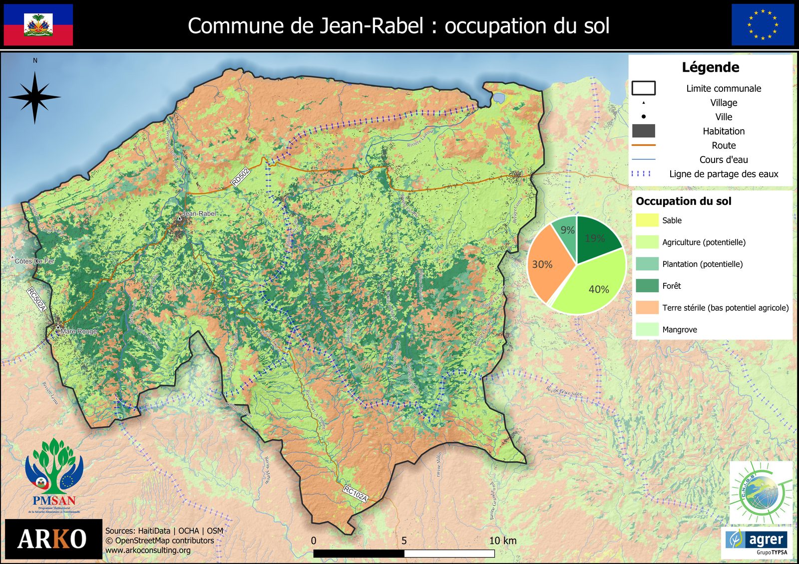
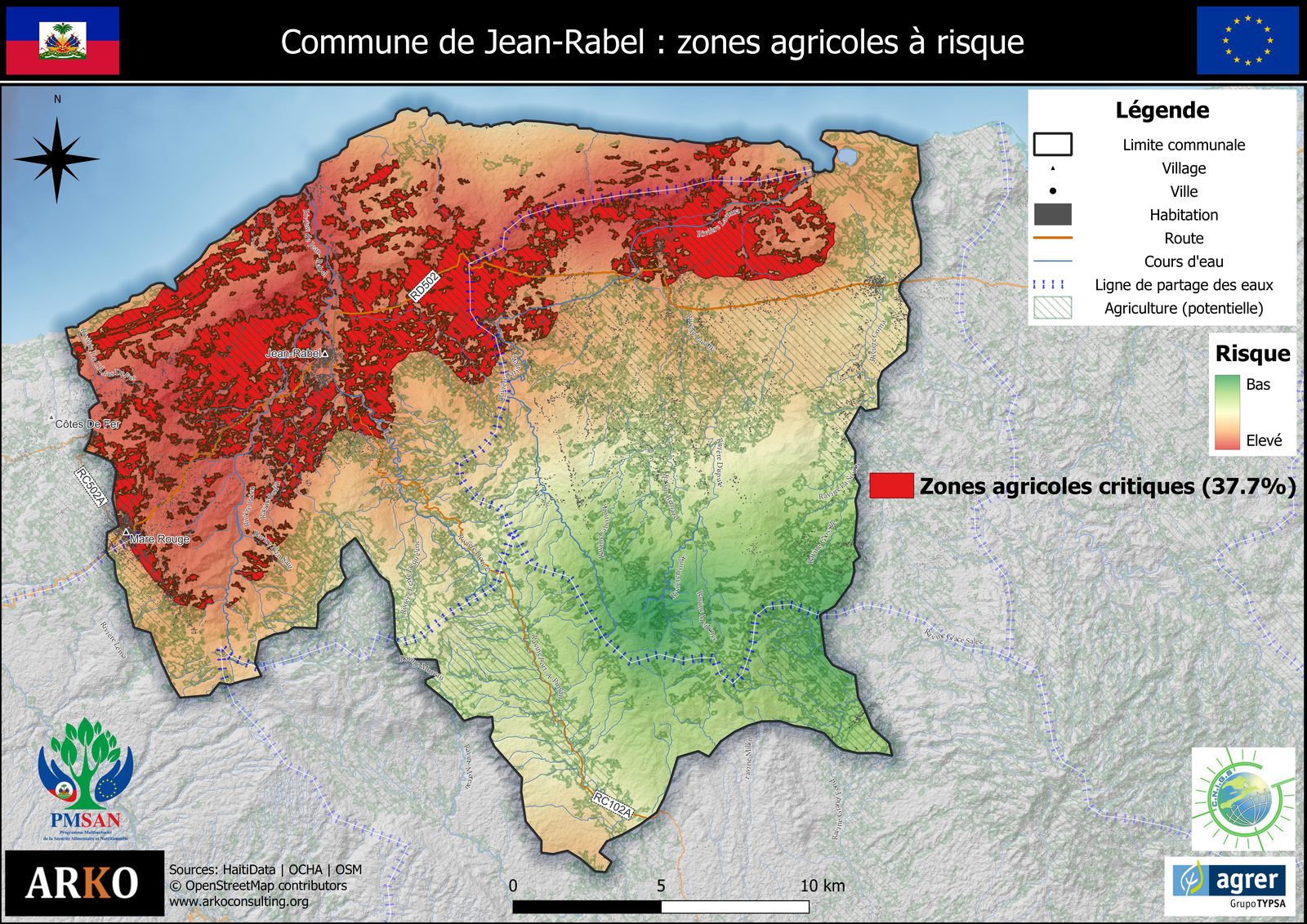
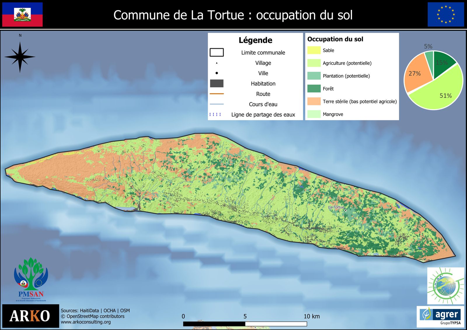
Field data + drone mapping + AI = complete decision-making system. These maps are not static images. They are designed to be cross-referenced with field collection data — household surveys, GPS measurements, participatory observations — to produce multi-criteria analyses, vulnerability indices, and georeferenced reports directly usable by donors and project teams.
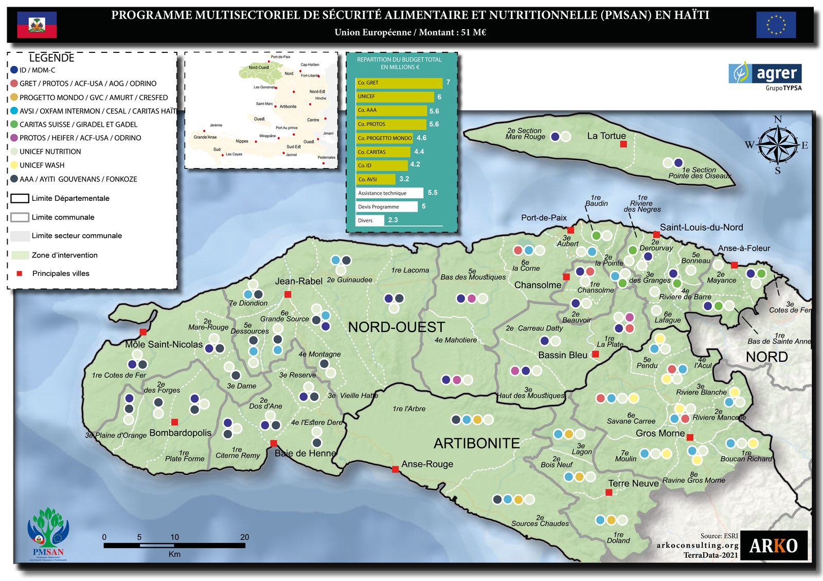
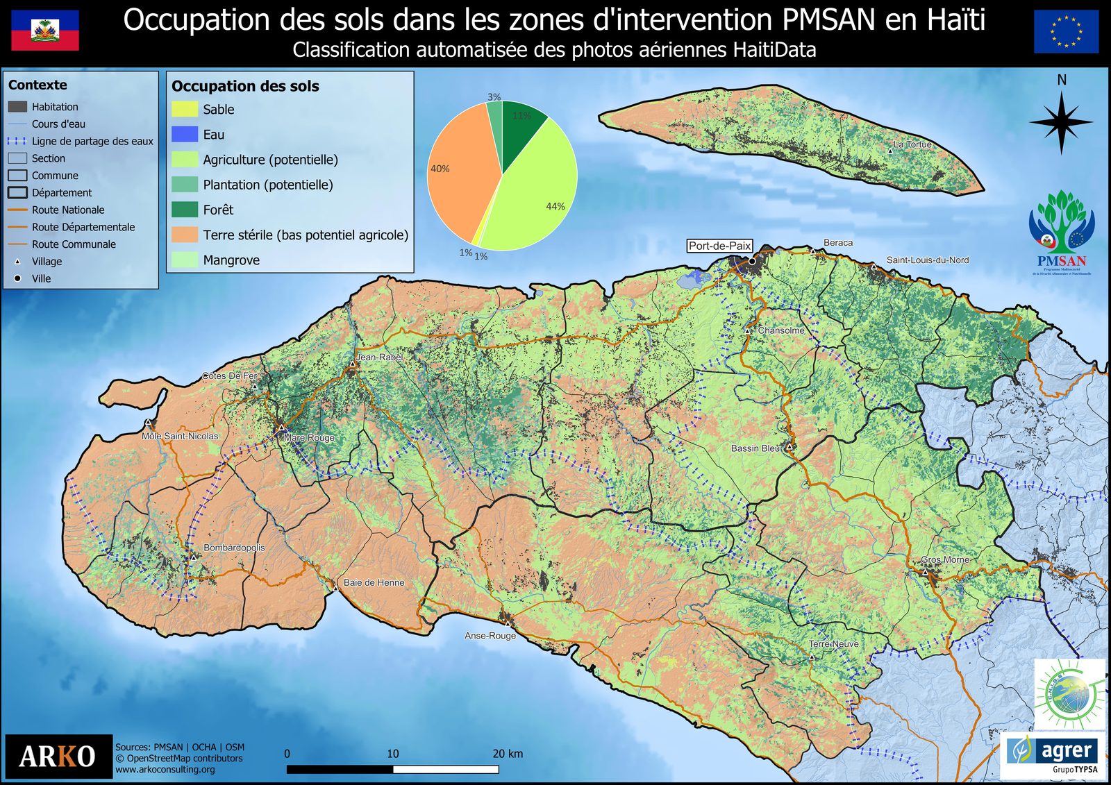
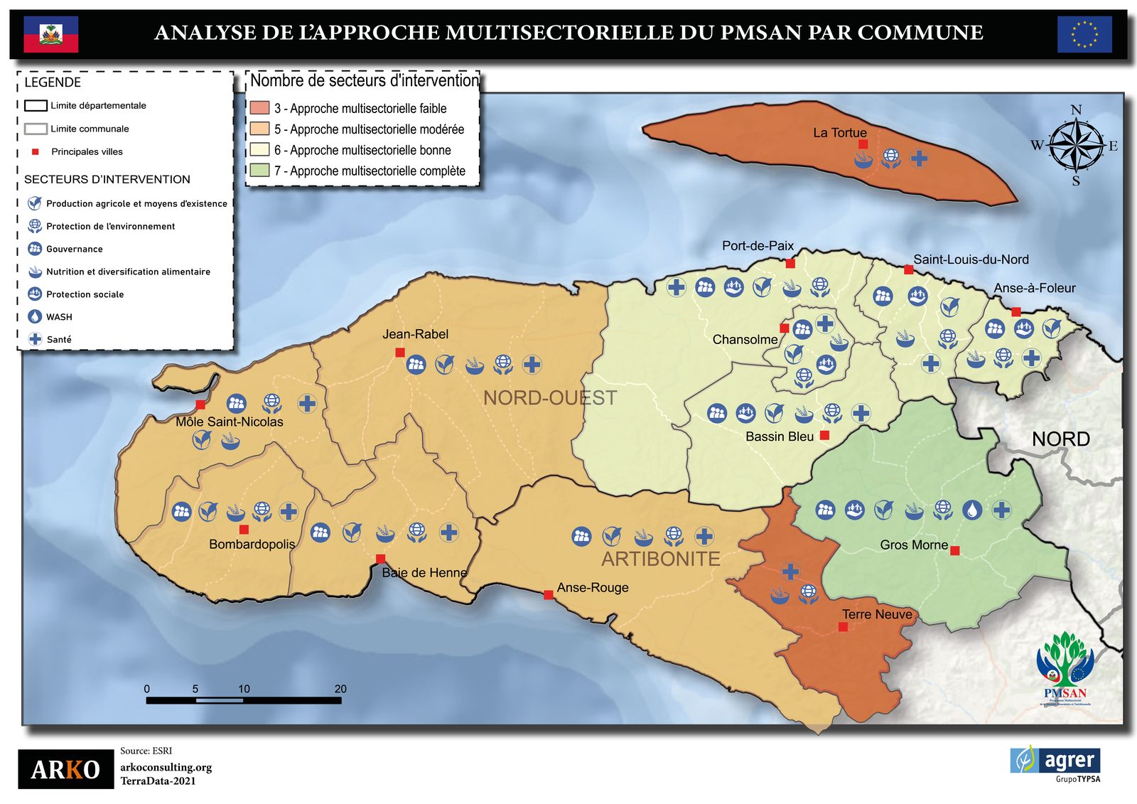
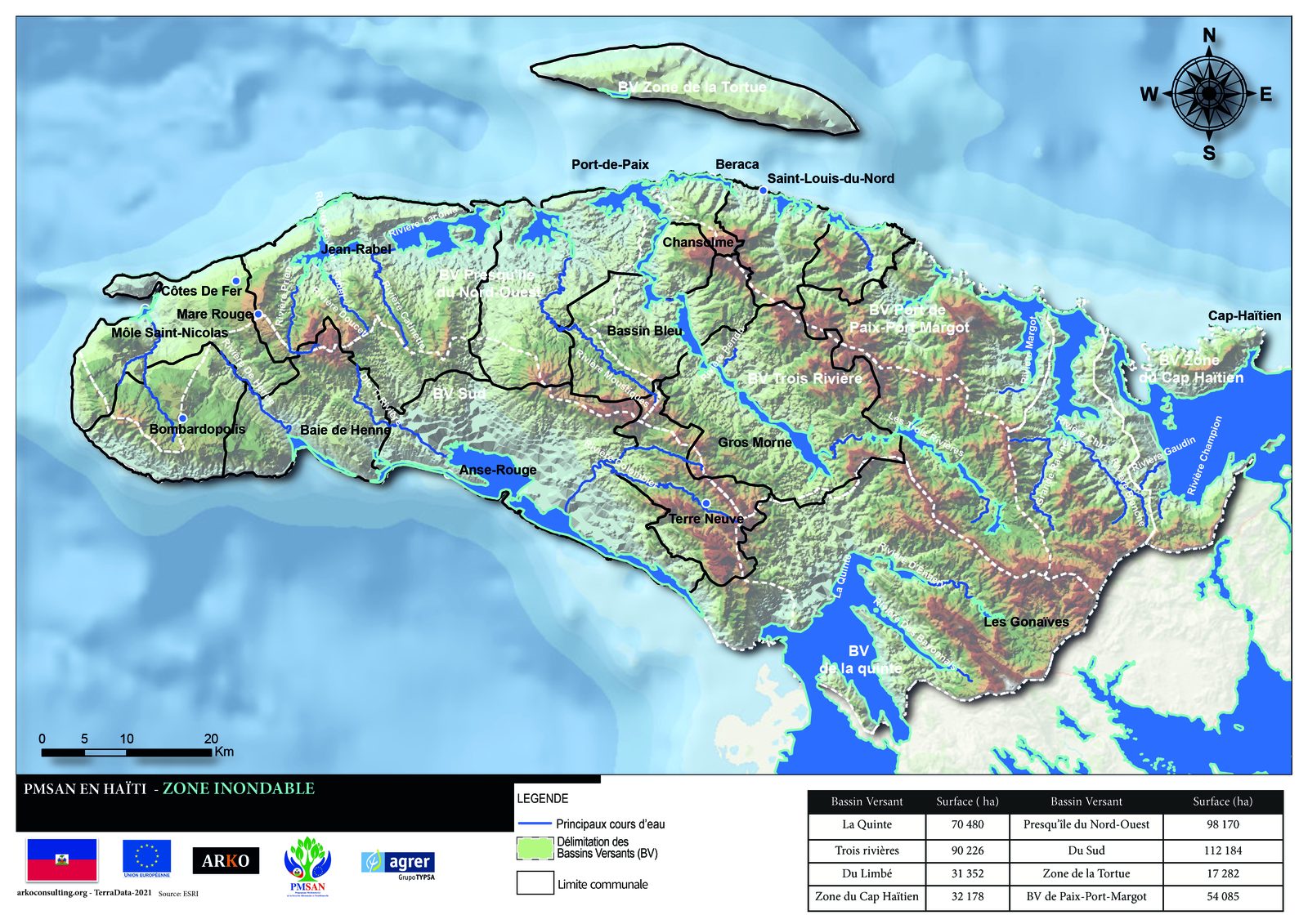
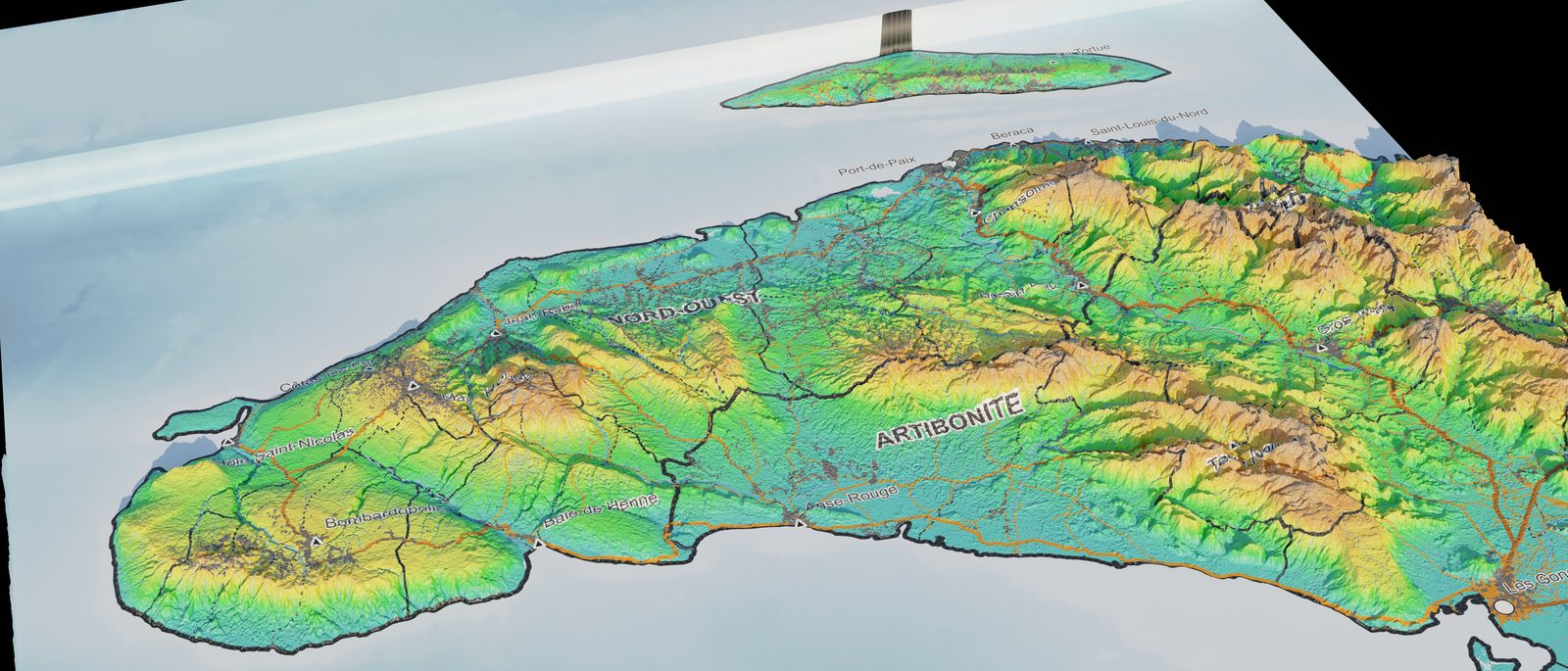
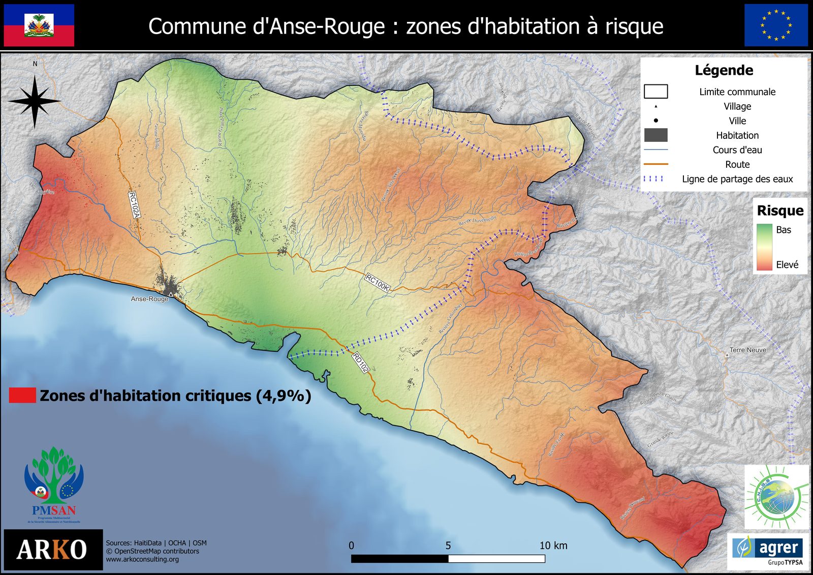
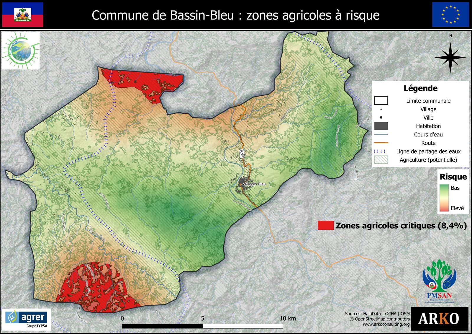
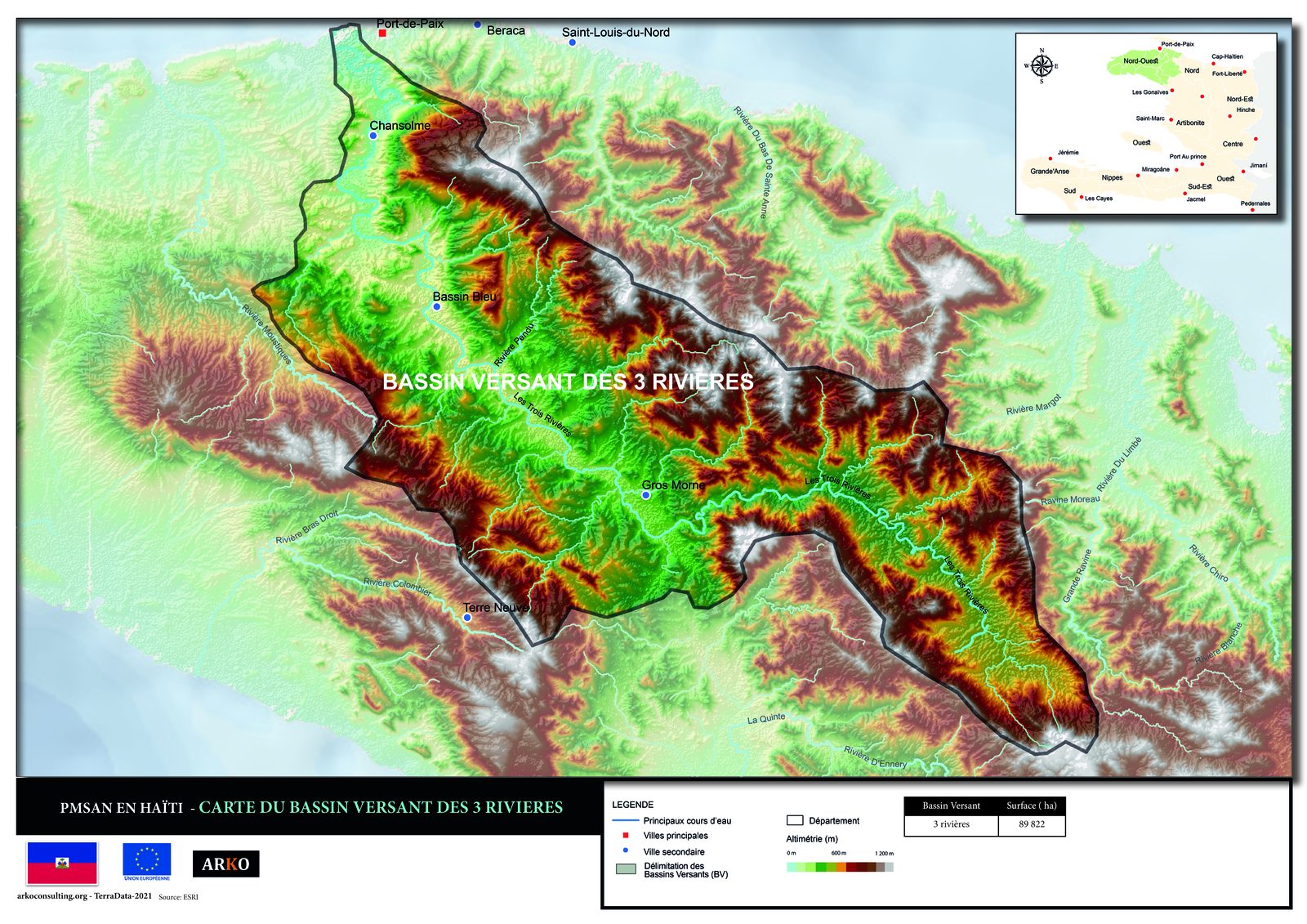
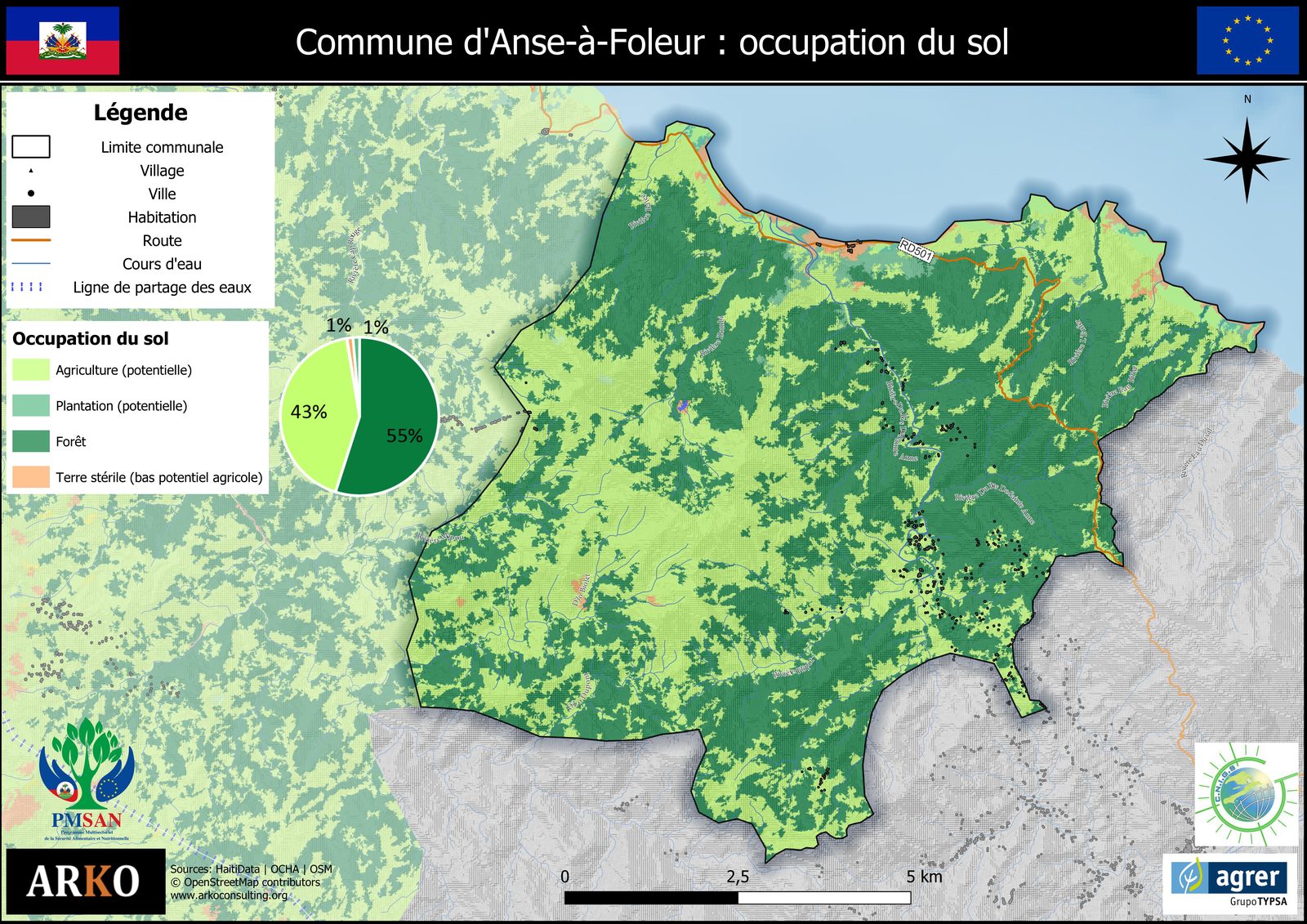
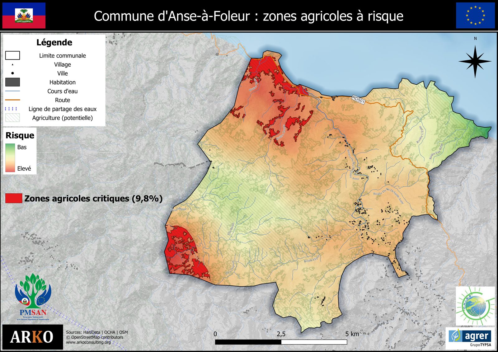
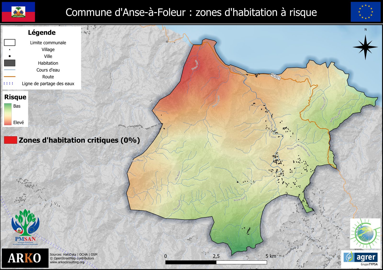
PMSAN Haiti Atlas — 69 thematic maps
Baseline produced for the AGRER/ArkoConsulting consortium — 12 municipalities, 4 thematic layers per municipality.
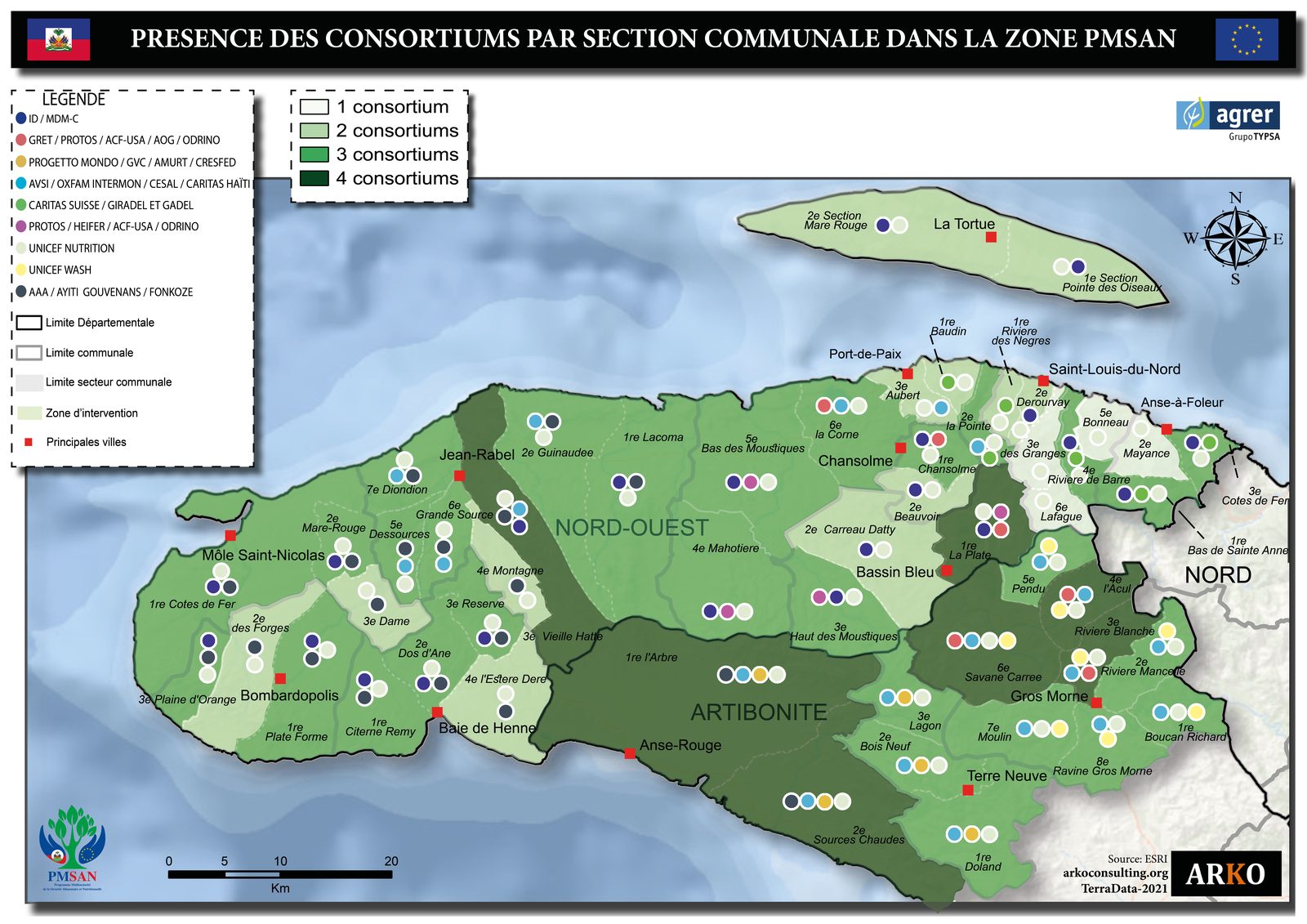
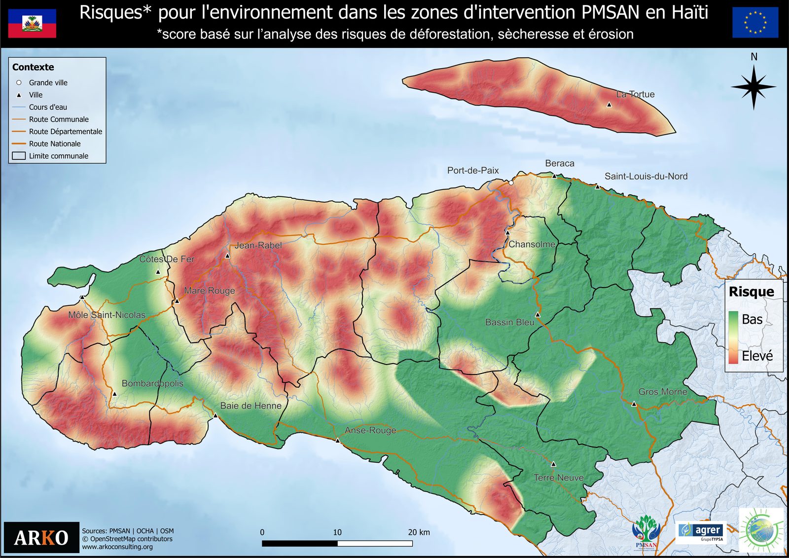
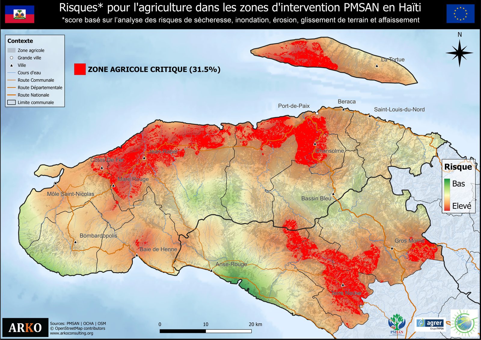
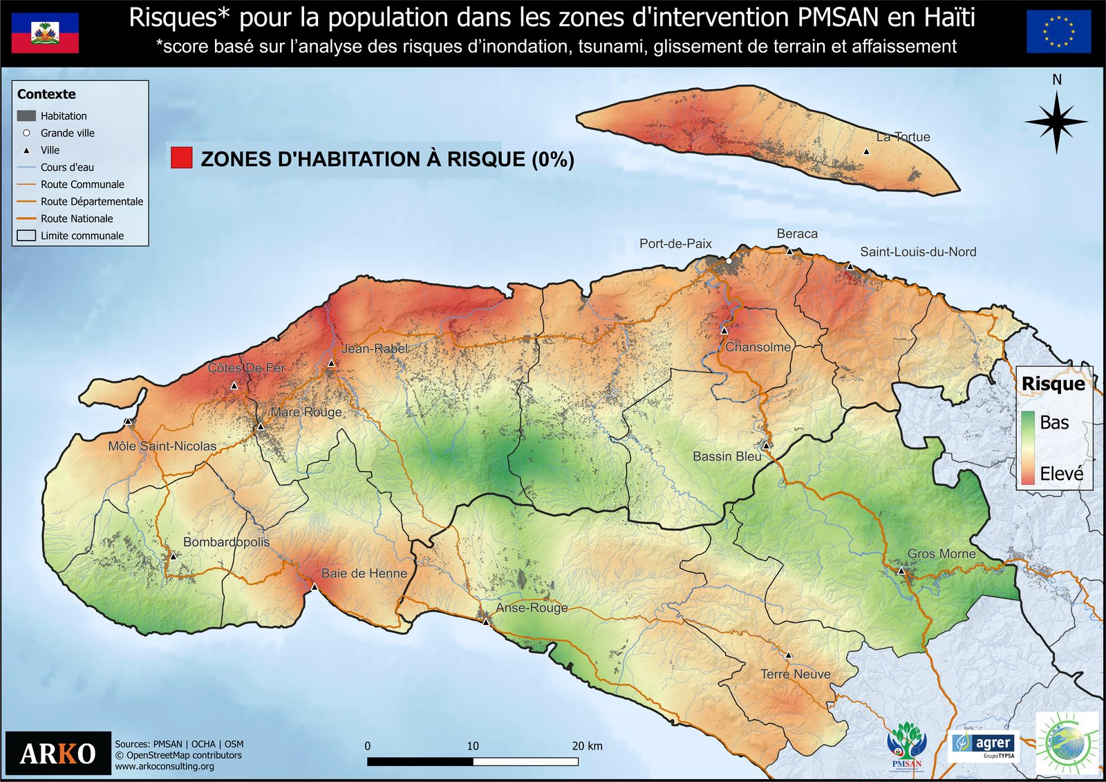
Municipality example — Anse-à-Foleur (4 layers)
Learn to produce and leverage this data
Modules B (photogrammetry), C (AI), D (development), and G (field)